Atlas
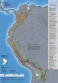
Este mapa incluye ecosistemas transicionales con el objetivo de caracterizar las áreas limitantes con los ecosistemas andinos. Estos ecosistemas transicionales son: Amazonia, Caribe, Chaco, Chiquitania, Desierto Andino, Desierto Subandino, Orinoquía y Tumbes-Guayaquil.
...
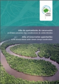
Nueva colección de mapas que revela datos hasta ahora desconocidos sobre la selva tropical más grande del mundo. Esta publicación, ha sido liderada por la iniciativa Visión Amazónica de REDPARQUES.
¿Qué tan vulnerable es la Amazonia frente al cambio climático? ¿Por qué las...
The Socio-Economic Atlas of Kenya is the first of its kind to offer high-resolution spatial depictions and analyses of data collected in the 2009 Kenya Population and Housing Census. The combination of geographic and socio-economic data enables policymakers at all levels, development...
Please join the International Renewable Energy Agency (IRENA) for a free training webinar on the Global Atlas!
The Global Atlas for Renewable Energy is a tool for initial prospecting of renewable energy...
IRENA, CENER (Spain), DLR (Germany), Masdar Institute (UAE), NREL (USA) and MINES ParisTech (France) are very pleased to announce the release of Global Atlas 2.0.
This new version features maps for solar, wind, geothermal, bioenergy and marine energy, and includes new...
IRENA, CENER (Spain), DLR (Germany), Masdar Institute (UAE), NREL (USA) and MINES ParisTech (France) are very pleased to announce the release of Global Atlas 2.0.
This new version features maps for solar, wind, geothermal, bioenergy and marine energy, and includes new...
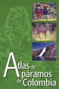
Este atlas presenta una recopilación y exposición de la información disponible sobre páramos en Colombia, con el propósito de contribuir a la elaboración a corto plazo de una línea base completa sobre estos ecosistemas para avanzar en los planes de manejo de páramos. La información...


