New online tool maps lands managed and protected by indigenous people
Indigenous people have historically demarcated their ancestral lands in a variety of ways, from rudimentary agreements and maps to, more recently, drone surveys. But until now, there has been no systematic way of recording the actual boundaries and legal status of each swath of land managed by native peoples, who, as research shows, often do a better job of protecting their lands than local or national governments.
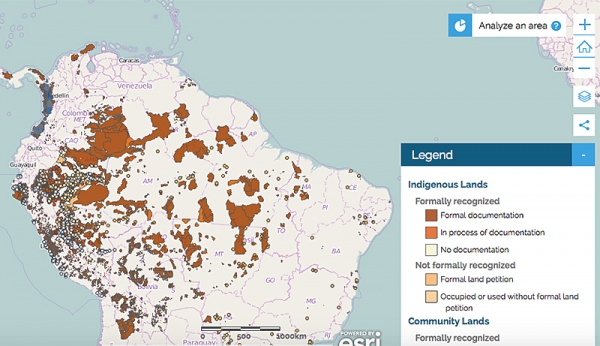
LandMark, a new tool launched today by a broad partnership including the World Resources Institute (WRI), is the first online, interactive platform for mapping lands managed by native communities.
It was created to fill a critical gap in indigenous and community rights and make clear that these lands are not vacant, idle, or available to outsiders for exploitative development such as mining, palm oil plantations, or timber concessions. But Abdon Nababan, secretary general of the Indonesia's Indigenous Peoples' Alliance, cautioned that “these maps do us no good unless they become public knowledge and indigenous rights are recognized by all who have ambitions to grab our lands.”
The international talks addressing climate change have yet to include indigenous communities' land rights as an agreed-upon tool to limit the amount of carbon that humans release into the atmosphere, the WRI notes.
Facebook comments