Roundup: Modeling Floods, Water Security, and Farmland
Tuesday, 9 February, 2016 - 10:33
Each week, GlacierHub highlights three stories from the forefront of glacier news.
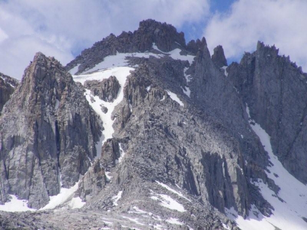
Modeling glacial lake outburst flood process chain: the case of Lake Palcacocha and Huaraz, Peru
From Hydrology and Earth System Sciences:
“One of the consequences of recent glacier recession in the Cordillera Blanca, Peru, is the risk of Glacial Lake Outburst Floods (GLOFs) from lakes that have formed at the base of retreating glaciers. GLOFs are often triggered by avalanches falling into 5 glacial lakes, initiating a chain of processes that may culminate in significant inundation and destruction downstream. This paper presents simulations of all of the processes involved in a potential GLOF originating from Lake Palcacocha, the source of a previously catastrophic GLOF on 13 December 1941, killing 1800 people in the city of Huaraz, Peru.”

To learn more about the research, click here.
Forum reveals new possibilities for water-induced disaster management in the Koshi basin
From ICIMOD:
“Top officials and experts from the Koshi region gathered in Patna, Bihar on Thursday for a two-day forum to discuss solutions around water security and water-induced disasters in the Koshi basin. Coming after years of devastating floods in southern Nepal and Bihar, the forum emphasised regional cooperation and collecting evidence-based data that can be translated into policy.”

To learn more about the research, click here.
The Changes in Regional Structure and Land Use Related to External Factors in Hussaini Village, Northern Pakistan
From Mapping Transition in the Pamirs:
“This study describes changes to regional structure and the use of farmlands in Hussaini village, Pakistan, caused by two events. The first event was the opening of the Karakoram Highway in 1978 that introduced commodities and a money market economy. The enhanced transportation increased access to markets, which spurred a transition from subsistence wheat cultivation and vegetable crops to potato cash crops. The second event was the catastrophic landslide in Atabad which occurred on 4 January 2010 that submerged part of the Karakoram Highway and created a dammed lake. The loss of the highway halted the village’s engagement in the wider agricultural market, and farmlands in the village reverted to traditional agriculture. The changes caused by these outside factors created confusion and disturbance and challenged the villagers to quickly adapt for survival.”

To learn more about the research, click here.
Source: GlacierHub
Work regions:
Mountain Ranges:
Facebook comments